Watersheds

A watershed is an area of land that catches and drains water into a creek, stream, or river via direct runoff or smaller tributaries. This water eventually ends up in a large body of water such as the Delta, Bay, or ocean. In other words, it is where the water from the higher elevations settles in lower elevations. Watersheds come in all shapes and sizes. They cross county, state, and national boundaries. No matter where you are, including your home, you’re in a watershed!
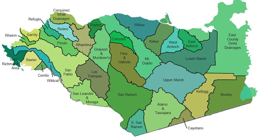
Contra Costa County has 31 major watersheds that drain to the Bay or Delta. Additionally, Contra Costa County includes the headwaters of creeks that drain through other counties before reaching the Bay.
Contra Costa County Watersheds
- Baxter, Cerrito, and West Richmond Watersheds
- Wildcat Creek Watershed
- San Pablo Creek Watershed
- Rheem and Garrity Creek Watersheds
- Pinole Creek Watershed
- Refugio, Rodeo, and Carquinez Area Watersheds
- Alhambra Creek and Peyton Slough Watersheds
- Walnut Creek Watershed
- Mount Diablo Creek Watershed
- Willow and Kirker Creek Watersheds
- East and West Antioch Creek Watersheds
- Marsh Creek Watershed
- East County Delta Drainages
- Kellogg and Brushy Creek Watersheds
- Upper Alameda Creek Watershed
- Upper San Leandro and Moraga Creek Watershed
Please view the Contra Costa County Watershed Atlas here:
Contra Costa County Watershed Atlas (PDF 141MB)

